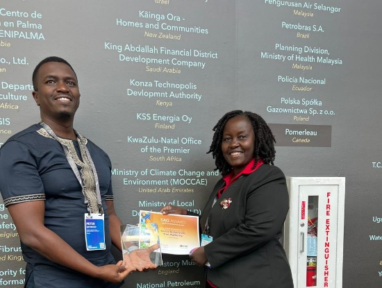
Kenya has emerged as a continental leader in geospatial innovation after Konza Technopolis received the prestigious Special Achievement in GIS (SAG) Award at the Esri User Conference held at the San Diego Convention Center in the United States.
The award places Konza among the world’s leading institutions using Geographic Information Systems (GIS) technology to address real-world challenges. Only six African countries were honoured with this distinction, making the win a landmark achievement for Kenya in digital urban development.
Konza Technopolis was recognized for its pioneering use of GIS in planning and managing its smart city infrastructure. The SAG Award, presented annually by global GIS software giant Esri, celebrates organizations that set new benchmarks in geospatial innovation.
“This award is a testament to Konza Technopolis’s unwavering commitment to integrating cutting-edge technology into the very fabric of our smart city development,” said CEO John Paul Okwiri. Arch. Annah Musyimi, Chief Manager for Physical Planning and Compliance, added: “Our strategic use of GIS is not just about maps; it’s about empowering smart, data-driven decision-making that improves the quality of life for residents and businesses alike.”
Konza’s award-winning initiative focused on two transformative projects: the creation of a Land Information Management System (LIMS), a digital spatial database for property and land use records, and the development of integrated 3D digital models using as-built CAD drawings. These innovations allow for efficient visualization, planning, and service delivery across the smart city ecosystem.
Key applications of GIS at Konza include:
- Integrated Urban Planning: Leveraging GIS for accurate land-use mapping, zoning, and infrastructure development to promote orderly growth.
- Smart Infrastructure Management: Real-time monitoring of utilities, transport, and public services to boost operational efficiency.
- Environmental Stewardship: Utilizing spatial intelligence for environmental assessments, conservation, and sustainable resource management.
Konza deployed advanced GIS technologies such as ArcGIS Server Enterprise Advanced, ArcGIS Urban Suite, ArcGIS CityEngine, and ArcGIS Online to achieve these milestones.
The award cements Konza Technopolis’s position as a rising global hub for innovation, technology, and sustainable urban development. It also highlights Kenya’s growing footprint in the smart city and digital transformation space on the African continent.
Written By Rodney Mbua


